It is early November and a cool breeze hits my face as I look out at the rolling hills, the rugged peaks of the Glasshouse Mountains to the south and Mount Coolum and Mount Eerwah to the north. It is difficult to imagine the violent and turbulent history that formed this country we walk on today and I am grateful that my guide on this journey is none other than Warwick Willmott. Warwick is an expert geologist with over 30 years’ experience working across the Sunshine Coast and SEQ region. He is leading a three day workshop series for Sunshine Coast Land for Wildlife members and is about to take us on a journey through time.
We start day one at Howell’s Knob, Reesville. Looking to the west we see the oldest rocks, complex meta-sediments, formed over 300 million years ago. These rocks were formed during an episode of intense deformation of deep-water sediments on the then ocean floor. The deformation of these sediments hardened and recrystalised many rocks into what is known as ‘meta-sediments’ (formed through this process of deposition and solidification of sediments). Some moulten magma was generated, and forced up in granitic bodies, which can be seen as large granite boulders on rocky slopes of the upper Mary River Catchment and found in the geologies known as the Booloumba and Amamoor Beds
On top of these old meta-sediments are the marine sediments and some lavas accumulated to form the Cambroon Beds and Cedarton Volcanics. We can see these younger volcanics on the ridgetops from Peachester to the colourful stones that line the creek beds of Booloumba and Little Yabba Creek at Kenilworth. Warwick explains with a wry chuckle that, at this point in history, the coastline as we know it was facing to the south of the continent. I look around to see the spellbound crowd, like myself, try to recalibrate their internal compass.
The most recent volcanic activity that formed the geology of the Sunshine Coast occurred in the middle of the tertiary period (~20-30 million years ago) and is evident from the rich basalt soils on the Maleny Plateau.
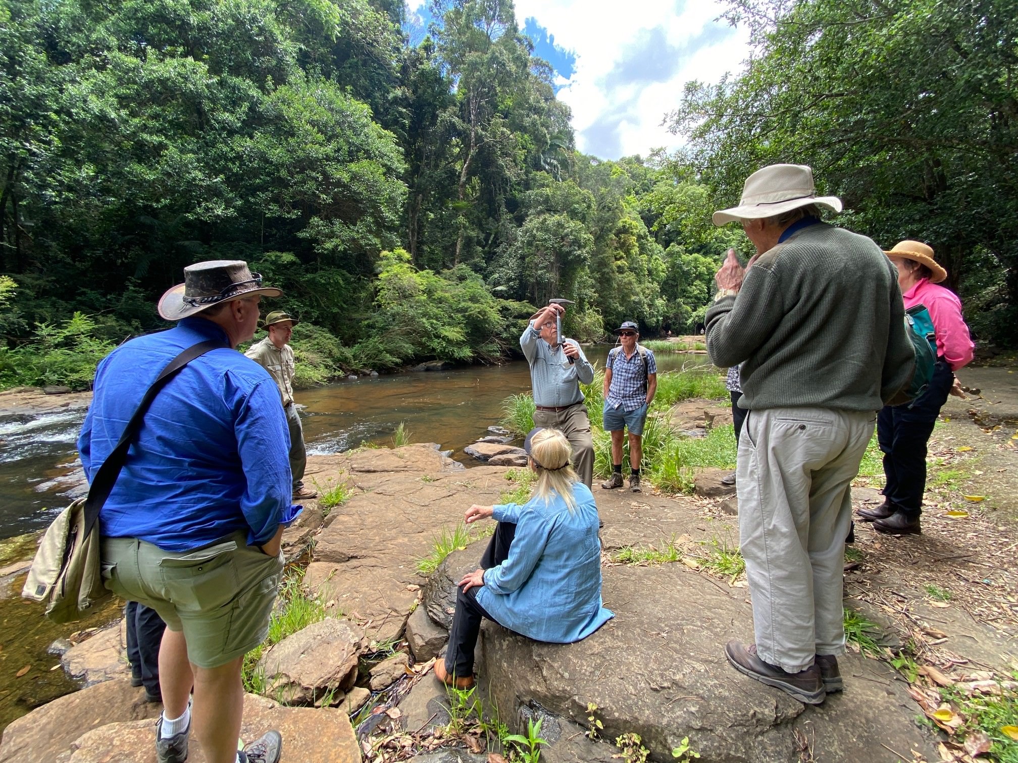
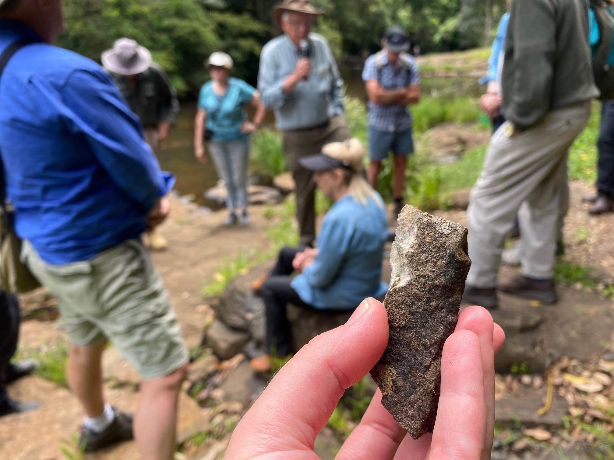
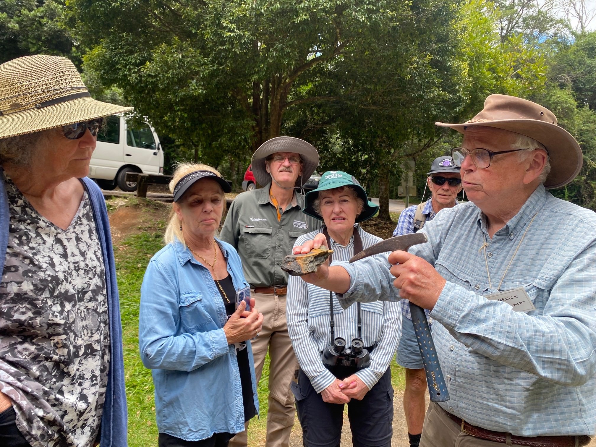
As we walk down the Obi Obi Creek at Gardners Falls, the striated flows of rock and large basalt boulders strewn on the banks of the creek appear almost frozen in time. Warwick picks up a small dark brown rock and cracks it open with his pickaxe. He explains that to identify a rock, you must break it open as the colour and texture on the surface is often weathered and not a good indicator of rock type. The inside of this small basalt rock is dark brown with whitish-grey crystals (see photo below). These basalt rocks weathers over time into fertile red or chocolate soils and we can see in the remnant rainforest that fringes the creek, this fertile soil provides the perfect growing material for the lush and diverse rainforest that extends across the Maleny Plateau.

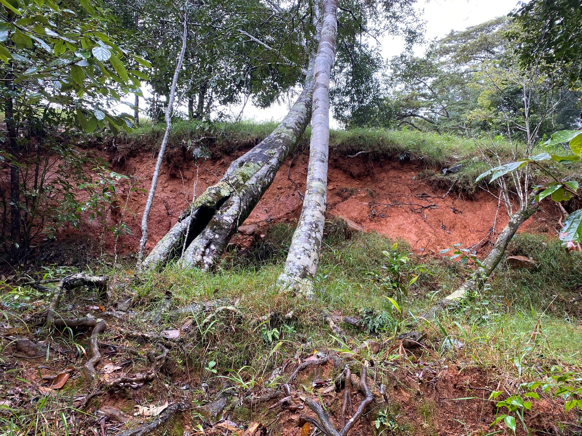
Our final stop on this whirlwind tour is Simon and Sue Gedda’s Land for Wildlife property that sits at the head of the Mary River Catchment. This property was historically cleared for grazing and like many properties, has multiple slips exposing dark red soils on steep terrain. Warwick explains that landslips occur on these soils due to:
- Long-term weakening of the internal strength and cohesion of the soil due to natural weathering.
- Bulk strength of surface soils are reduced due to vegetation clearing. Large trees manually help bind the soil together with deep roots, but also draw out water from the soil, making the soil ‘lighter’ and not as prone to slipping downhill.
- Loss of effective strength possibly caused by groundwater pressures developing within the soil.
Warwick highlights the importance of revegetating cleared areas and planting species selected for their water uptake ability (e.g. Hoop and Bunya Pines) as well as their capacity to withstand some soil movement. As we walk down a steep track, we can see areas where a large slip has left a big orange scar and Bunya Pines are standing tall but on a slight lean, indicating movement of the soil below.

As we sit down to wrap up day one of our geology tour, I hear the buzz of excited voices explaining the challenges of managing landslips and the management tools that have worked well to stabilise slip areas. There are a variety of management practices that have been tried and tested in landslip areas on these basalt plateaus including installing leaky weirs, re-directing water flows on steep slopes and revegetation. However, I notice one common theme between all the stories and learnings shared throughout the workshop. There is a resilience and adaptability that extends beyond the restoration of a single patch or property. It is the adaptability and knowledge-sharing between experts, neighbours and new friends that is the highlight.
The following two days of workshops continued this journey through our rocky geological past. In the end, I was left standing in quiet reflection on top of that same hill where our story began. Although this three-day journey was but a speck of sand on the geological time scale, the knowledge shared, and connections built in the community will be shared for years to come.
Article and photos by De-Anne Attard
Land for Wildlife Officer
Sunshine Coast Council
Reference
Willmott W (2007) Rocks and Landscapes of the Sunshine Coast. Revised Second Edition. Geological Society of Australia, Brisbane.