There’s been a lot of media focus since recent record flooding in the Lockyer Valley on the human impact of these events. Perhaps less well known are the environmental impacts of such intense storm events.
We live in the southern part of the Lockyer Valley along Spinach Creek adjacent to Dwyers Scrub Conservation Park and have been members of Land for Wildlife for quite a number of years.
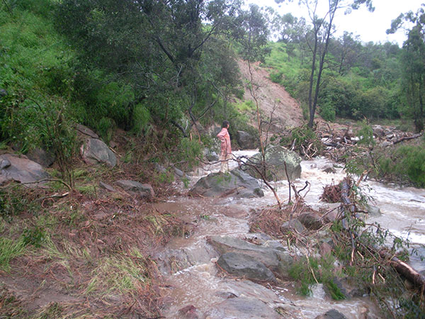
The first thing a visitor would notice in this area is the large number of land slips, there are literally hundreds. These generally occur on certain soil formations usually associated with Brigalow Scrub, remnant or cleared, and to a lesser extent, vine scrub.
These soils are formed from rock known as Winwill Conglomerate, which is a sedimentary layer extending about 30 – 40 metres above the valley floor. This means that when slips occur, the soil goes directly into the creeks or adjacent to them.
The clay layers exposed are usually sodic and highly dispersing. Subsequent rainfall is less easily absorbed and run-off creates rills down the slip face, which in many places brings sediment and salt directly into the creek water. The plume of silt can extend for some distance downstream. No doubt the salt and nutrients would affect Moreton Bay and the Brisbane watershed.
Many aquatic creatures are susceptible to changes in water quality – invertebrates, cray sh, amphibians and small fish such as Bony Bream and Purple-spotted Gudgeons, which are normally abundant in Spinach Creek when it is running as it is.
On top of this, the physical nature of Spinach Creek has changed dramatically since the events of January 11th which here was much more intense than the 1974 floods. The creek has changed from a V shape to a side U shape.
“…what we saw here in January was probably the equivalent of hundreds of years of soil movement concentrated into one event and may take many years to recover.”
The water height and volume was such that giant boulders weighing many tonnes had been moved down stream and, in a kind of domino effect, the predominant vegetation along the creek bed, Black Tea-tree (Melaleuca bracteata) have 80% disappeared, either completely torn out by the roots or broken off , with smaller trees laid at. With the resilience of the system, some of the remaining fallen tea-trees are starting to re-shoot and lomandras are starting to re-grow.
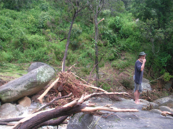
Judy Whistler inspecting the changes to Spinach Creek after the devastating floods of January.
In the short term tea-trees are a very obvious source of nectar for birds, mammals and insects such as native bees. Because a large number of creeks in this region were similarly affected, creatures which rely on such vegetation have little alternative refuge.
With advice from SEQ Catchments we are attempting remedial actions, through the planting of deep rooted native trees such as Belah (Casuarina cristata) above recently appearing cracks in the soils and creeping grasses such as salt tolerant couch and vetiver in herring-bone patterns across the slip faces.
In conclusion, while the land form in this area has been shaped by land slip and rock fall, what we saw here in January was probably the equivalent of hundreds of years of soil movement concentrated into one event and may take many years to recover. With more extreme weather predicted with a changing climate the future may well hold more intense wet periods and perhaps more intense dry periods.
Article by James Kerr and Judy Whistler Land for Wildlife members Fordsdale, Lockyer Valley