The majority of native vegetation that once grew on flat land in SEQ has made way for urban, industrial and agricultural uses. Consequently, much of the bushland that remains today occurs on steep slopes. For this reason, many Land for Wildlife members are faced with the challenge of managing hilly properties with steep gullies, slopes and escarpments. I have met many landholders that have areas on their property that they deem to be ‘inaccessible’. Indeed, this lack of access prevents many landholders from managing and enjoying their property as much as they would like.
Activities such as weed control, revegetation and fire management all require adequate access. Good access makes property management easier, saving time and effort. Having a network of access tracks on your property can not only help you achieve your property management goals it also enables greater enjoyment of your property. The number and type of tracks required will vary depending on property size, terrain and how you need to access areas. Property access tracks can vary from 4WD or ATV tracks, fire management trails or low impact, single-file walking trails.
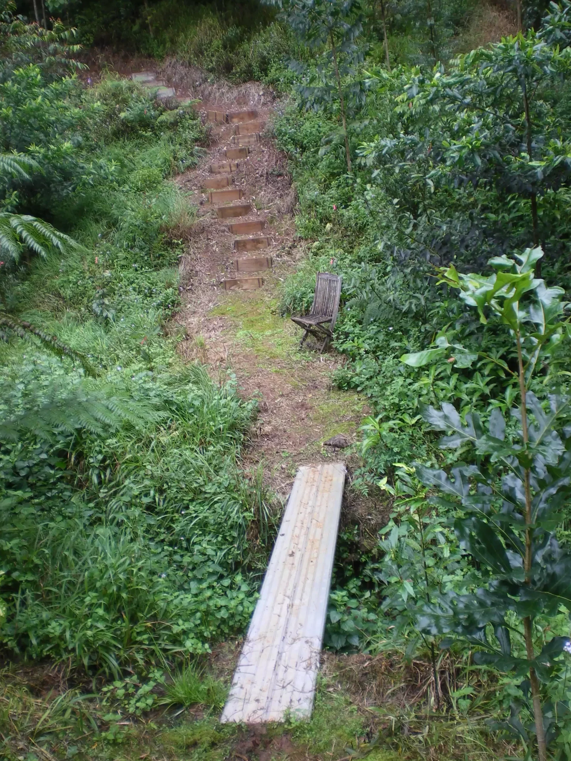
Over the years I have seen examples of both good and poor track construction, including some incredible examples of landholders creating access across extremely steep terrain. From hand-crafted tracks built with a strong back and a hoe to suspension bridges across waterways. On one property on the Blackall Range escarpment, the landholder has established access that is traversable on their ride-on mower on a slope that would challenge a mountain goat! This allowed them to get the necessary materials for weed control and revegetation to most parts of their previously ‘inaccessible’ property. While not everyone is willing to go to such extremes, if establishing walking tracks on your property is something that you have always wanted to do, here are some tips to get you started.
Firstly, what is the purpose of the track? Is it an occasional walking track down to the creek or to a favourite vantage point or is it a track that will double as a containment line for fire management? Tracks can have multiple purposes and it pays to think through your management and access needs prior to starting. If you have existing infrastructure running through your property such as overhead wires, pipelines or fences you can ‘bundle’ tracks along the same alignment to avoid the need for any additional clearing of vegetation.
How much use will the track get? Does it need to be permanent or is it just to access a large lantana patch until it has been regenerated and therefore a temporary access track will suffice? Will the track be one-way, terminating at a lookout and a seat for contemplation or will it be a loop track or part of a network of connecting pathways?
Most privately owned forests in SEQ have been selectively logged or farmed in the past and will still have old ‘snigging’ or farm tracks, often hidden by lantana and thick regrowth. Hillshade maps generated with LiDAR technology are available online (https://qldglobe.information.qld.gov.au) and are a great resource for locating old overgrown tracks. These tracks often follow the top of ridgelines or spurs with snig tracks cutting into gullies following the contour across slope. Locating and re-opening old tracks rather than establishing new ones can reduce disturbance as well as saving time and money.
For single-file walking tracks you can also look for existing animal tracks or old cattle tracks that are often found following a gentle grade along the contour across steep slopes. Again, this approach of working with what you’ve already got can minimise the impacts associated with the creation of a new trail through the bush.
Creating access tracks is not without an environmental impact. Tracks can fragment bushland, provide pathways for weeds to disperse and feral animals to follow. They can also alter natural hydrological flows and poorly constructed tracks can cause erosion and sedimentation. For this reason, good design and construction methods are crucial.
To help plan your tracks, start with a contour map or hillshade map. If you don’t have access to these your Land for Wildlife Officer may be able to help. Once you have a basic layout in mind, it’s time to walk the proposed route. Digital apps such as Avenza Maps are a useful tool for walking potential routes and mapping them digitally as you go. Walk and mark the trail using markers such as flagging tape at regular intervals, ensuring they are visible from one marker to the next (and in reverse). Take your time to get the alignment right and move the tape up or down the slope as required. Deciding the exact route for a new pathway can take longer than the actual construction!
As much as possible, it is best to follow the contours across the slope. Tracks should not exceed slopes of 10% or a 1 in 10 change in elevation. Steeper slopes may require the use of ‘switch-backs’ in order to avoid inclines greater than this.
Tips For Track Construction
• Take time to carefully plan and mark out tracks prior to starting.
• Follow contours across the slope at less than 10% incline and not exceeding 15%.
• A trail’s grade shouldn’t exceed half the grade of the hillside (half-rule).
• Tracks should allow water to get away – crossfall the track tread outwards.
• Regularly reverse the grade.
• The more drainage the better to avoid erosion.
• Use a bench cut construction for contour trails, bench will need to be retained.
• Install regular ‘whoa-boys’ on steep vehicle tracks.
• Coir logs can provide an alternative to mechanically constructed whoa-boys.
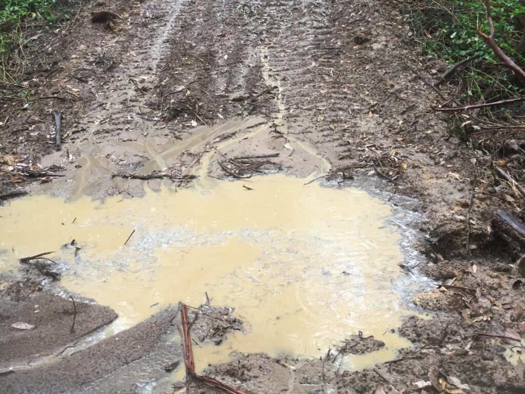
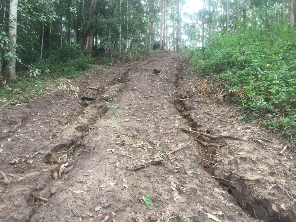
These are two examples of what not to do when constructing tracks.
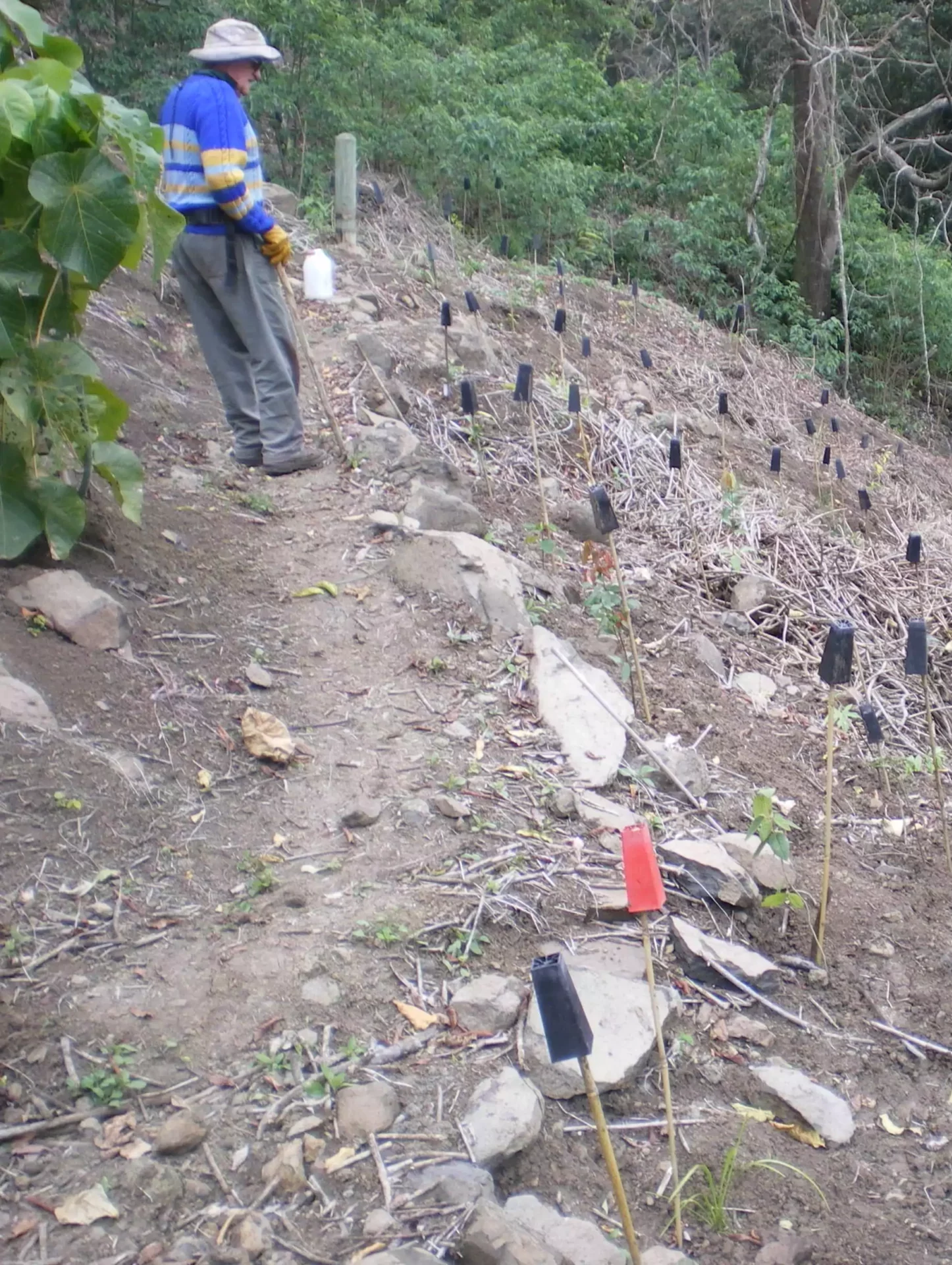
For new tracks, it is inevitable that some disturbance to native vegetation will occur, especially to groundcovers such as grasses, herbs and ferns. If you are going to impact native vegetation, then its important to know what it is you are disturbing. If you don’t know what a plant is, then find out before you remove it (ask your Land for Wildlife Officer) to ensure that it is not a rare or otherwise significant species. If your alignment passes close to a tree, pass it on the upslope to help avoid root damage. While bush rocks are a handy, cheap local source of materials for retaining a bench-cut track, removing them will disturb the habitat for a range of small fauna, so they are best left alone.
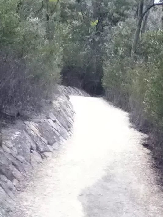
Drainage considerations and preventing erosion is a major factor in track design and construction. Consider your soil types along the track alignment and their erosion potential, try to avoid areas that are susceptible to erosion. A well-made track should disperse water off the track regularly and doesn’t allow the track to become a watercourse in heavy rain. This can be achieved by ensuring that the track has a crossfall that results in water running off the track in sheets rather than along the track in concentrated flows. When water drains in thin, dispersed sheets, soil tends to remain on the track. Regular grade-reversals with drainage turn-outs will also help reduce the likelihood of gully erosion and wash-outs.
For steeper sections on fire trails or vehicle tracks the construction of ‘whoa-boys’ is necessary to divert large volumes of water off the track during heavy rain. For walking trails you may want to consider building steps with diversion drains for very steep sections, especially in rocky areas.
There are a range of online resources such as trail building manuals and guidelines that provide detailed technical information regarding trail construction. These are generally aimed at government agencies such as National Parks that are building high-use hiking trails, but the fundamental principles remain the same for private properties. There is also a growing amount of mountain bike trail construction resources available including online videos. While the needs of mountain bikers differ to those of a Land for Wildlife landholder, the general concepts behind good trail construction remain the same.
Well designed and constructed contour trails can get you from the top to the bottom of your hill and vice-a-versa without raising a sweat and are much kinder on ageing knees! They also make it safer for you when you are lugging equipment from one end of your property to the other. A nice walking trail also provides a pathway to follow that can help you forget about the weeds for a while and simply enjoy your land for wildlife.
Article and photos by Nick Clancy
Land for Wildlife Officer
Sunshine Coast Council
References & Further Reading
www.publications.qld.gov.au/dataset/soil-conservation-guidelines (Chapter 14 Property infrastructure)
www.publications.qld.gov.au/dataset/science-notes-soils
www.southaustraliantrails.com/files/wp-content/uploads/2017/03/trail-design-guidelines.pdf
www.environment.nsw.gov.au/research-and-publications/publications-search/guidelines-for-the-planning-construction-and-maintenance-of-tracks
Enjoyed reading these tips as about to start creating pathways for pleasure and weed management