Discovering you have a weed list of 48 species on your property can be somewhat confronting. However, quantity alone cannot measure the task at hand – a list of 12 weed species may mean a higher workload than a longer list. Lists don’t speak to abundance, distribution, threats or values. In land management, all is not what it appears at first sight, and therein lies the importance of growing your knowledge and contextualising your property planning for the on-ground outcomes you want.
Every property in the landscape is unique and presents its own set of conservation and land management challenges. However, the list of these challenges is not endless and there are often commonalities in a catchment area. For example, weed seed spreading downstream means properties on the same river might have similar riparian weeds. Heavy grazing on steep slopes may influence erosion and landslips, sending sediment downstream.

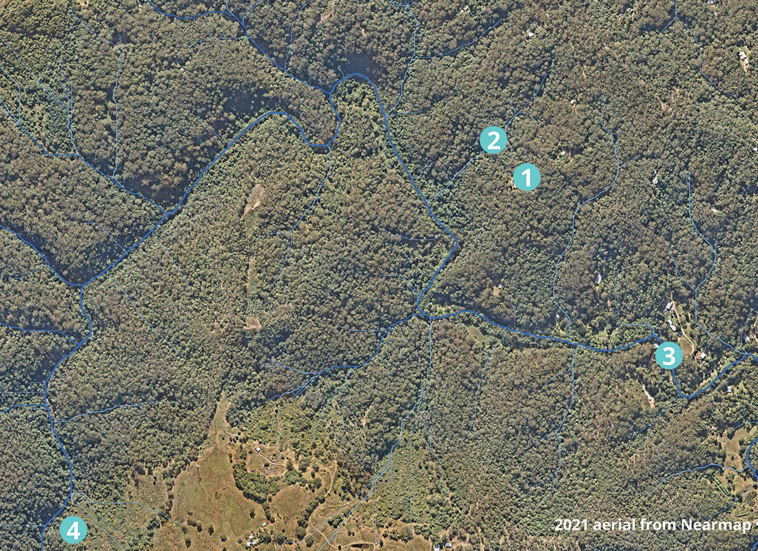
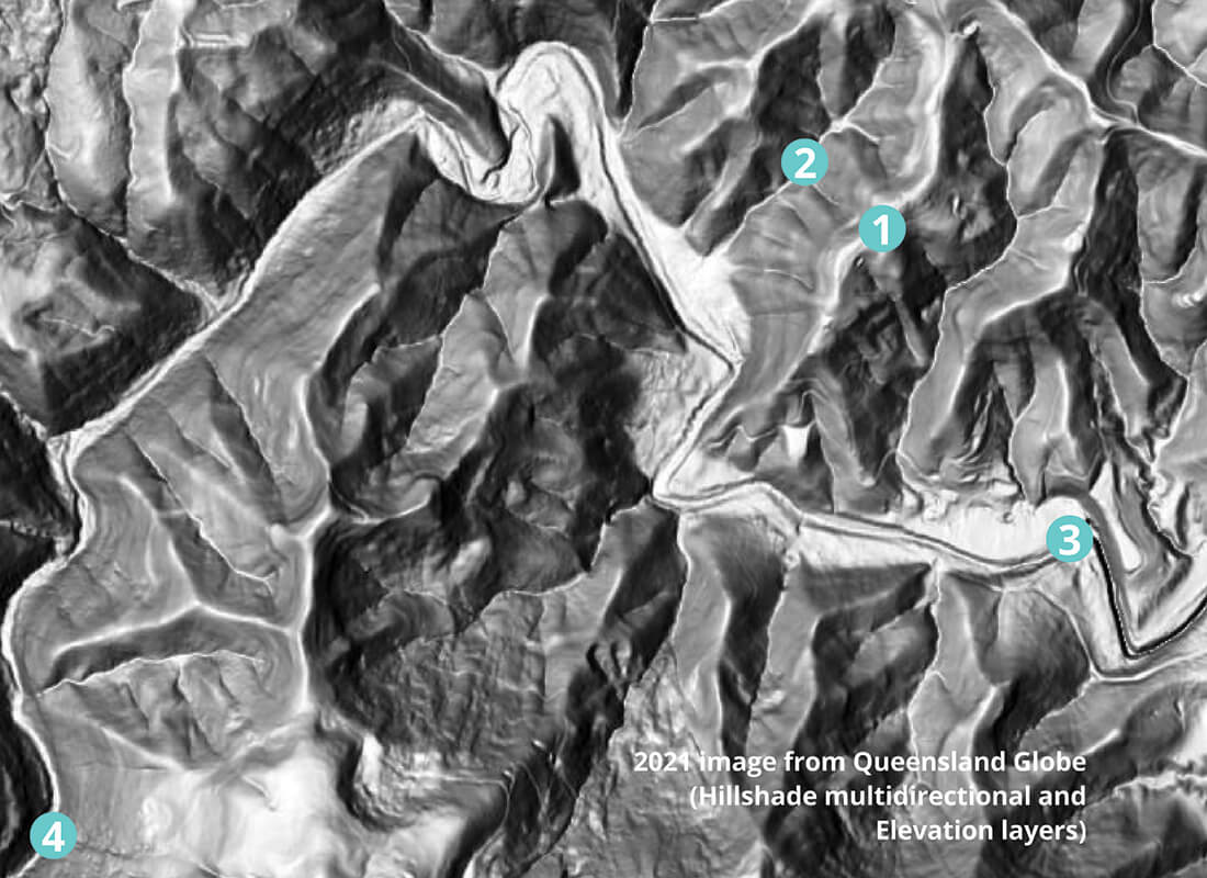
These three images show the same section of a catchment on the Sunshine Coast. Steep areas in the upper part of this catchment (label #4) were historically cleared for agriculture and are prone to landslips and weed invasion. Sediment from landslips and erosion can run into creeks and rivers downstream, reducing the overall health of the system. Vegetation in the catchment surrounding the river provides natural filtration and reduces the impact of sediment entering the waterway downstream in the mid-catchment (label #3).
In a 100m stretch of the mid-section of this river, 48 weed species were observed, including high priority weeds such as Morning Glory and Madeira Vine. Some of the weed species recorded were historic garden escapees that have become highly invasive over time. Many of these weeds were washed downhill or downstream into this mid-section and have opportunistically taken up residence on a new property.
Conversely, unique values are often shared across the landscape too. Potoroos and Koalas do not understand the property boundaries they cross, crayfish move through cool streams, Powerful Owls nest in the most suitable hollows and frugivorous birds chase the juiciest fruit in the rainforest canopy. All the while, the seeds of host vines for threatened species of butterflies and moths are being washed downstream and are quietly germinating on a creek bank.
Understanding and contextualising your property within the landscape is as important as recognising the unique set of challenges and priorities you are managing.
The good news is that your Land for Wildlife Officer is here to help navigate you through the challenges, and it can be quite an enjoyable and rewarding journey.
Prioritising your challenges is the first step in getting to know your property. Getting to know your list of weeds is just the beginning. On that extensive weed list your officer gave you, there may be only a two or three high priority weeds that need your immediate attention. They may be located upstream or uphill or in an endangered ecosystem, so the environmental threat is higher. If the weeds are in the middle of the paddock, they probably fall further down your priority list. Concurrently, your property might have an actively eroding creek or landslip that requires immediate attention and some of those weeds are providing stability – suddenly revegetation has jumped the queue. Add to this a significant patch of healthy remnant vegetation, requiring little else than cattle exclusion fencing – a quick and easy win.
As you can see, there are often competing priorities in the context of an individual property. Juggling time and resources, new projects, maintenance (and more maintenance) can be reminiscent of a complex logistical challenge. I’ve often described land management as a dance – you find a property you connect with, you learn the technical skills needed, and your footwork gets faster with practice. It’s as much about ‘doing’ as it is about thinking and feeling.
Now you’ve settled into your property, perhaps you’ve been there a year or two, maybe much longer and the goals have shifted. You’ve reopened some old management tracks and explored new areas, created a bird list, or perhaps undertaken a revegetation project or two and some weed management. Whatever your situation, the intricacies of your property have become clearer to you, and so the next step is to create a longer-term action plan.
Environmental property plans are often five to ten years – any longer and they become more of a guide than an action plan. They require regular review since new challenges often present themselves, and therefore the original priorities shift. They give you a point of reference to help maintain focus on your goals – a road map of sorts. They consolidate your past efforts and investment and give you an opportunity to reflect on your achievements.
Whether you do this process internally or on paper with management zones and a checklist of actions, maintaining flexibility and adapting to change is key.
No two properties or landholders I visit are the same, this is what gets me out of bed in the morning and leaves me happily exhausted at the end of each day. Land for Wildlife Officers have the privileged role of guiding landholders as they interpret their landscape and provide objective advice from an ecological and scientific perspective. Whether you are new to the program or are ready to review your plans, your Land for Wildlife Officer is available to help you achieve your on-ground ecological outcomes.
To delve more into understanding the context of weeds on your property, please see Nick Clancy’s informative article on page 10 of this newsletter.
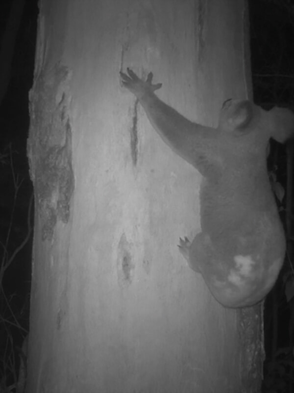
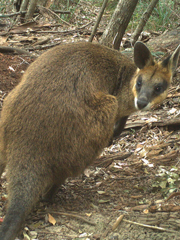
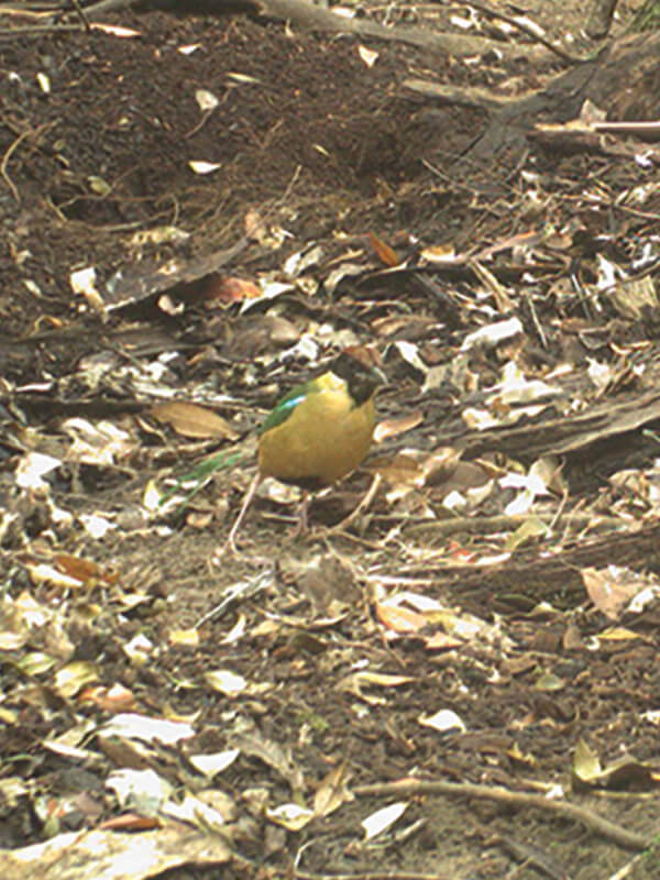
Connecting corridors and supporting healthy habitat is essential for the survival of wildlife as they move through the landscape and cross multiple properties along the way. This Koala, Noisy Pitta and Swamp Wallaby were photographed on a Land for Wildlife property in the upper reaches of the catchment pictured above. Due to historic clearing surrounding the property and landscape formations, these animals may be limited in their ability to safely travel much further. Revegetation that create safe havens and connects vegetated corridors across property boundaries is essential for such wildlife.
Resources
Queensland Globe (free)
qldglobe.information.qld.gov.au
– Current aerial maps and layers such as biota, elevation and geology
QImagery (free) qimagery.information.qld.gov.au – Historical aerial imagery
Nearmap (subscription) nearmap.com/au/en – High resolution aerial maps
Kylie Gordon
Land for Wildlife Officer
Sunshine Coast Council